
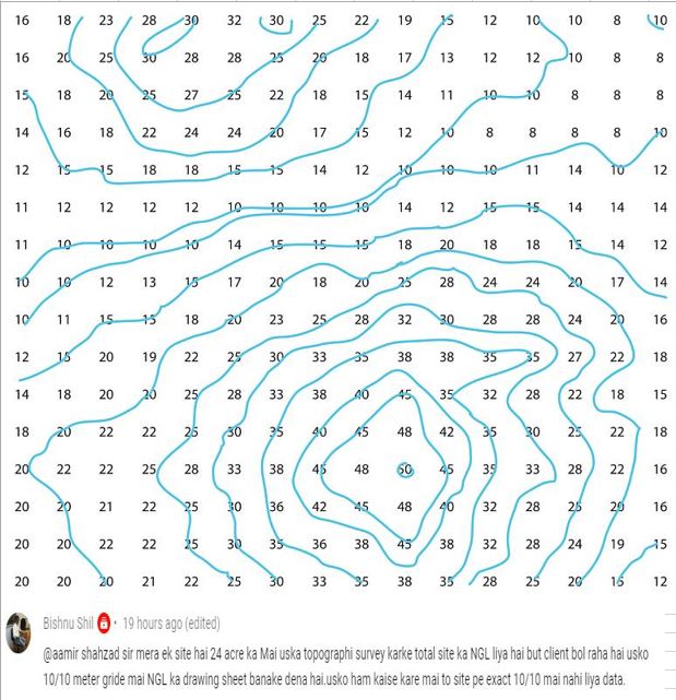
This is 89th of Q&A and in this video, I answer one question which I received on youtube comments and the question is how to draw topo survey data in Grid 10 in 10 meters squire. For the answer to this question, I used AutoCAD Civil 3d and I use excel and AutoCAD file which I received by email 1st I Create a surface from topo points then make grid points using Civil 3d For complete training of civil 3d click on the link given bellow https://www.youtube.com/playlist?list=PL6lSnhW4YFv5NnfhxJrTzIQ3R3rY6kiw4 For watching all Q&A videos click on the link given bellow https://www.youtube.com/playlist?list=PL6lSnhW4YFv5HFo4io6JP3ZRXOs_yRulN For visiting My Dailymotion channel click on the link given bellow https://www.dailymotion.com/aamirshahzad216 For visit, my Website click on the link given bellow https://aamirshahzad216.com/ For visit, my FaceBook Page click on the link given bellow https://www.facebook.com/Aamirshahzad216-105377167600580 For visit, my Blog click on the link given bellow http://aamir2016.blogspot.com/

I want to give the value and rl of 2 tbm. I mean station data and back side data, I want to give the value of these two. I searched for many videos but couldn’t find them. Please make a video like this.
LikeLike